


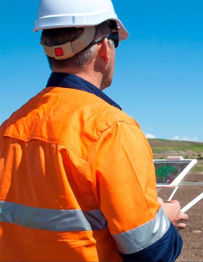
SURVEY PROJECT MANAGEMENT
We provide comprehensive project and construction management services for all types of building, industrial, and civil engineering projects. Our expertise spans various sectors, including civil engineering, industry, infrastructure, real estate, construction law, and environmental management. Our services include:
-
Construction Management
-
lProject Programming
-
Design Management
-
Procurement and Purchasing
-
Installation Management
-
Quality Management
-
Inspections
-
Property Development
-
Time and Cost Control

BUILDING AND PLANT CONSTRUCTION SURVEY
We offer high-quality technical expertise and functional solutions tailored to meet your specific business needs, including:
-
Building Defects Investigation and Analysis
-
Bill of Quantities (BoQ) Verification Service
-
Building Lifespan Studies
-
Measurement Services: Lux level, sound level, thermal imaging, dampness, and more
-
Technical Due Diligence and Feasibility Studies
-
Building Condition Surveys: Civil, MEP, and Structural
-
Specialist Structural and MEP Testing
-
Specialist Structural and MEP Testing
-
Lender’s Engineering Reports

UNDERGROUND UTILITY SURVEYS & DRAWING (GPRS)
Underground Utility Surveys and Drawing, commonly known as Ground Penetrating Radar (GPRS), are essential for locating the position and depth of both metallic and non-metallic objects, including gas lines, communication cables, sewer lines, underground storage tanks, and PVC pipes.
GPRS offers significant advantages for various applications, such as environmental assessments, geological investigations, archaeological studies, and road inspections. We utilize advanced machinery specifically designed for this purpose, ensuring a well-structured approach to achieve our objectives effectively. Our team of skilled professionals is the backbone of our operations, bringing invaluable strength and experience to every project.

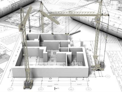
DESIGN & DRAFTING SERVICES
Our expertise in 2D CAD drafting, architectural CAD services, engineering CAD services, structural CAD drafting, CAD conversion, and paper-to-CAD transformation positions us as a leading provider of cost-effective and precise CAD drafting solutions in the engineering industry. With a professional team boasting extensive knowledge and experience, we offer CAD services in Dubai and internationally. We provide a comprehensive range of CAD drafting, design, and 3D modeling services tailored to meet your specific needs.

OFFSHORE / ONSHORE OIL AND GAS FIELD SURVEY
We offer highly recognized offshore and onshore oil and gas field surveys in the UAE. Our team of experienced surveyors is adept at identifying potential oil and gas fields using advanced machinery and technologies while prioritizing sustainability and feasibility. Additionally, we are licensed to conduct both onshore and offshore oil and gas field survey activities in the UAE.
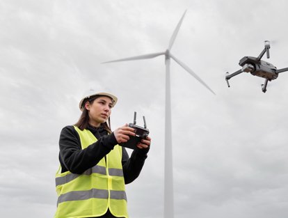
UAV SURVEY AND PHOTOGRAPHY SERVICE
We offer UAV survey and photography services across the UAE using a highly portable and advanced drone system. In today's market, traditional aerial photography has become less sought after; clients now demand real-time, high-resolution, and sharp images. Our company is dedicated to delivering just that and much more.
Our drone system is designed for easy transport and durability, allowing for quick mobilization and availability on short notice. Operating below cloud cover, it is less affected by weather conditions. In autonomous mode, the autopilot efficiently manages location-triggered image captures with the help of onboard GPS and IMU technology.
ARCHITECTURAL AS-BUILT SURVEY WITH 2D & 3D FORMAT DRAWING
We specialize in architectural as-built surveys, utilizing advanced 2D and 3D drawing formats, including laser scanning technology. This innovative approach, which was once solely a precise survey instrument, is now the industry standard for achieving highly accurate measurements in complex environments. Our company aims to be a leading provider of these cutting-edge technologies.
With the capability to capture survey data points at an impressive rate of 50,000 per second and a scanning range of 400 to 500 feet, we can set up multiple scans within a structure to create a comprehensive 3D model. These detailed models serve as the foundation for producing 2D civil or architectural drawings, as well as 3D computer models.
ALUMINIUM CLADDING WORKS
We also offer Aluminium Composite Cladding (ACP), made up of two smooth aluminium sheets thermo-bonded to a polyethylene core, available in both fire-rated and non-fire-rated options through a continuous co-extrusion process. The exterior aluminium surface is treated with a premium coil coating, which comes in a wide range of standard colors and can be customized to suit your preferences. One of the standout features of ACP is its versatility—it can be easily shaped, sized, and carved for various applications.

STRUCTURE SETTLEMENT MONITORING SURVEY
All structures, monuments, and residential buildings are susceptible to degradation from the inevitable effects of time, including aging, fatigue, corrosion, and natural disasters. Some structures hold significant historical value, making their preservation crucial. These structures require regular settlement monitoring to prevent partial or complete collapses, which pose serious threats to both lives and property.
As these concerns grow, structural health monitoring of concrete structures has emerged as a key focus of research in recent years. The following tasks are essential in structural settlement monitoring surveys:
-
Stability and health monitoring services.
-
Ensuring the safety of buildings, monuments, and structures during nearby construction activities (such as underground tunneling and deep excavations for high-rise buildings).
-
Assessing the safety of multi-story buildings, hotel complexes, corporate offices, and other critical infrastructure.
-
Evaluating the safety of older and deteriorating buildings subjected to long-term movement or material degradation.
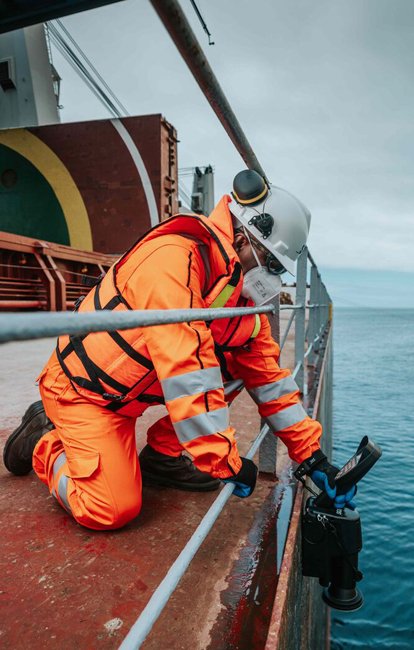
MARINE SURVEY
When discussing the top engineering surveys in the UAE, marine surveys are essential. Our company specializes in hydrographic, bathymetric, and geographical survey services that encompass a wide range of hydrographic disciplines. Our skilled hydrographic surveyors utilize advanced sensors, cutting-edge technology, and software to deliver customized solutions tailored to your specific needs.
We adhere to a rigorous process for selecting our survey systems, considering several factors before commencing work. These factors include the scope of work, water depth, operating frequency, distance from shore, accuracy requirements, seabed conditions, and vessel size.
Our marine survey services include:
-
Offshore positioning
-
Side scan sonar surveys and mosaicing
-
Sub-bottom profiling and magnetometer surveys
-
Beach profiling
-
ADCP/current meter observations
-
Pre- and post-dredging bathymetric services
-
Multibeam and single-beam bathymetric surveys
-
Tidal observation
Let’s Get Started
Reach out today for precise and reliable survey solutions.